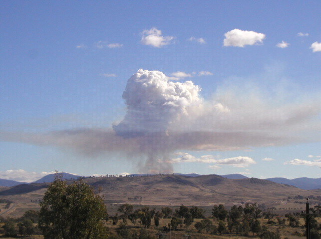
This photo shows a sylvicultural prescribed burn under way (hidden behind Mt Stromlo). A number of key points can be seen as the convection column rises above the fire.
The smoke initially rises and mixes with the surrounding air.
At the LCL, a cloud forms, but leaves behind a large fraction of the smoke. Note that the LCL there reflects the DP within the plume, which incorporates moisture generated during biomass combustion. In the photo the cloud base within the plume is thus well below that in the surrounding air.
The smoke spreads out in a layer at the LCL.
The pyro-Cu cloud rises for a considerable distance above the LCL.
Field Observer
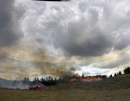
This photo shows cloud base over a slash burn. It indicates how the cloud base can be lowered over the convection column. While not a problem for a slash burn, in a wildfire it should be cause for further reconnaissance.
Situation Unit Officer
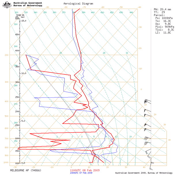
In this Aerological Diagram it is seen that the LCL is at 909hPa, or about 1km ASL. If enough heat was the plume it would punch through that and reach the major inversion at 840 hPa or 1.5km ASL. The amount of biomass being consumed (and thus moisture released) could not be directly assessed remotely. Satellite imagery would indicate cumulus formation potential.