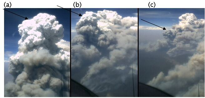
Collapse of a towering pyro-Cu cloud. The photos were taken from the NSWRFS linescan aircraft at FL70 and show three views of a distinct convective event that formed over the Flea Creek Fire while that fire was in its early stages of escalation. The views are (A) at 15:04:21 with an apparent height of at least 9 km; (B) the cell dropping (top left) at 15:05:31 to 7 km; and (C) the cell has dropped to 4 km above ground and lost its cloud (just above photo centre) at 15:06:44. Analysis of these photos suggests that a cloud of volume c. 50 km3 descended at over 150 km/hr. The impact the resultant downburst on fire behaviour would be spectacular – but in this case was unobserved. Note the upwards movement of a large cell in the background, at similar speeds.
Field Observer
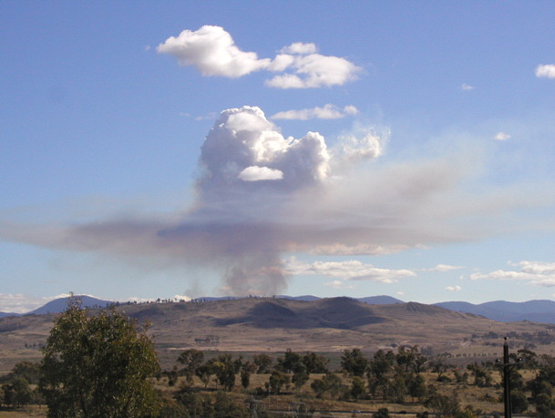
This photo shows key features of the collapse of a pyro-Cu.
From time-to-time variations in the fire’s intensity remove the buoyancy driving the pyro-Cu’s development, and it partially collapses. The same effect can occur if winds aloft push the pyro-Cu away from its heat source. The collapse leaves behind residual smoke above the LCL, visible above and to the right, reflecting upper winds. A cloud remnant (pyro-fractocumulus) is seen surrounded by a halo of its smoke.
Analysis of a photo sequence shows that this was a cloud tower 2.5 minutes previously, indicating a descent velocity of the order of 50km/hr.