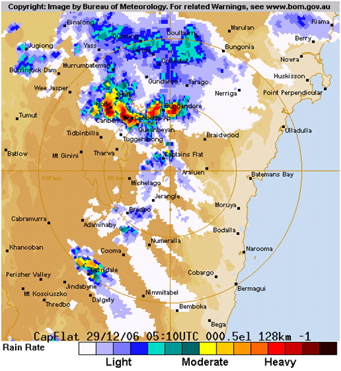
This image is from the BoM Weather Watch radar at Captains Flat. It shows how thunderstorm activity can be ordered into bands that may move across the region. In this instance an E-W bands of intense cells was moving to the south, while a NE-SW oriented bands was forming on a sea breeze front moving slowly to the west. All anvils are showing that upper winds are NW.
Complex patterns like these can be a challenge for fire IMTs.
The web tools provided by BoM should be used to estimate arrival times. Care should be taken to account for storm cell life-cycles. Also a watch for pyro-Cbs is essential, as the instability needed is guaranteed if there are already Cbs in the region.