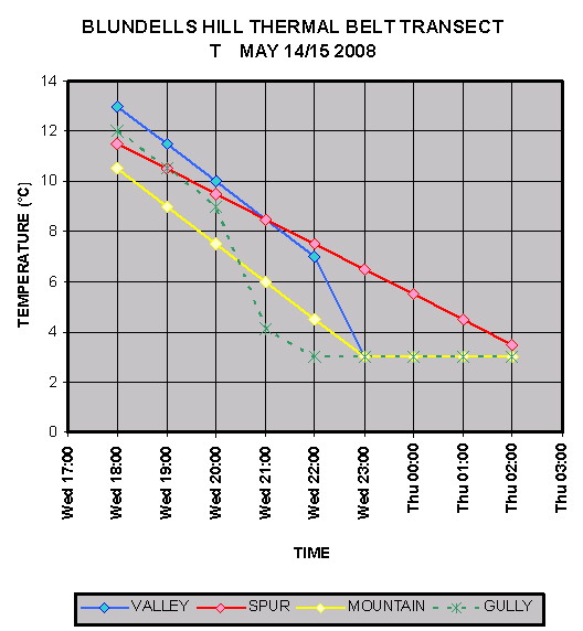
This graph shows a model of the formation of a thermal belt in a mountain valley west of Canberra. The curves fitted to observational data taken on representative places in the landform.
The key point is that late in the night, even though the spurs are cooling, they become the warmest parts of the landscape. Corresponding models for DP and FFDI show that the spurs can support unexpectedly high fire behaviour. Note that base camps and observation sites are rarely placed on spurs. The thermal belt may be missed unless deliberate observations are made.
Observers should note the clear skies, light winds and a continental air mass are considered prerequisites for a thermal belt to develop.