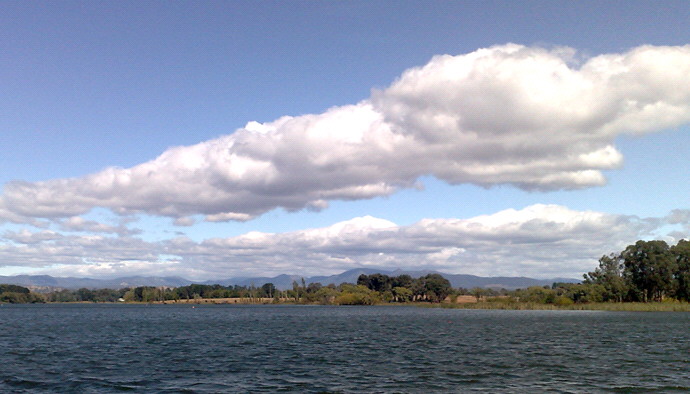
Event (8) Parallel bands of clouds, transverse to prevailing wind direction
Air Observer or Field Observer
In this photo the clouds bands can be seen to be parallel to the ranges upwind, on the horizon. These are clear indicators of vertical air flow within wind waves or rotors downwind of the ranges. Vertical air flow over fires can modify the stability with predictable effects on fire behaviour. Observers need to note whether or not the bands are geostaionary, and whether there is any reversal of ground winds in the troughs of waves (which would indicate rotor formation).
Situation Unit Officer
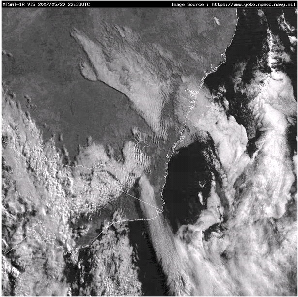
The image shows a complex weather pattern over south east Australia, which includes a Foehn-like event over Bombala. Centred around the ACT is a clear system of parallel wind-wave clouds being generated by the main range.
NE of the ACT there is not a main range, but wind-waves are also being generated there by the high ground around Crookwell and by the coastal escarpment around Nowra.